, exact location withheld
How to Research the History of an Abandoned Building
Start with the parcel number, then work back through maps, deeds, permits and old newspapers. The free records that tell an abandoned building's story.
To research the history of an abandoned building, start with its address and parcel number, then work backward through the assessor’s record, maps, deeds, directories, permits and old newspapers. Most of that is free, and no single record tells the whole story.
This is research you do from a desk, which is also the safest way to do it. It’s entertainment and general information, not legal advice, and none of it is a reason to enter a building. It also starts once you have a name or an address. I keep most of my own locations private for reasons I explain here, so this guide works best on buildings that are already public or that you’ve found yourself.
Where do you start?
With the parcel number. In Cook County, Illinois, it’s called a PIN, and the Cook County Clerk explains that it’s 14 digits, a 10 digit base plus a four digit suffix for condominiums and leaseholds. The clerk says the best source for a PIN is a deed or a tax bill. If you don’t have either, the Assessor’s website can look one up from an address, but the clerk warns that “matches are not guaranteed,” so confirm the match, for example against the property photo the Assessor’s office usually provides.
Once you have the PIN, the Cook County Assessor’s tool shows estimated market value, assessed value and property characteristics. It also covers permits, divisions and consolidations. Every county has its own version of this, so search for your county’s assessor.
Treat the result as a lead and not as the answer. The Virginia Department of Historic Resources, in its guide to researching a historic property, says to start at the tax assessor for the current owner, latest deed, parcel number and construction dates. It also warns that “the accuracy of these records can vary depending on the method of data collection that was used.” A construction date in a database may be an estimate, so you’ll check it against other records.
What can old maps tell you?
Fire insurance maps are the best tool for urban buildings. The Library of Congress says Sanborn maps were made to help insurance agents judge fire risk, and they show building size, shape and construction, plus fire walls, window and door locations, sprinklers and roof types. They also show street names and widths, property boundaries, building use, and house and block numbers.
The collection dates from 1867 to the present and covers about 12,000 cities and towns in the United States, Canada and Mexico. The Library of Congress holds the largest surviving set and has digitized the public domain sheets, which it says anyone can view and download for free. Those are the sheets published before 1923, plus those published before 1963 whose copyright wasn’t renewed.
Look at several editions of the same block. A building that appears, grows an addition, changes its labeled use from dwelling to store, or loses a neighbor is telling you what happened to it, and the labeled use shows what a building was for. The Virginia guide adds that Sanborn maps show each building’s footprint and construction materials in urban areas.
Where do you find old newspaper stories?
Newspapers give you the human version, including openings, fires, sales, closures and the names of owners and builders. The National Endowment for the Humanities describes Chronicling America as an open access database of historic American newspapers created with the Library of Congress. It covers papers from 1690 through 1963 and reports over 13 million pages.
For Illinois, the University of Illinois library runs the Illinois Digital Newspaper Collections, which it describes as free to search, free to browse and free to download. It lists five collections, including Illinois newspapers, farm newspapers, vaudeville papers, student papers and Black newspapers, and reports 251,254 issues from 249 newspapers. Anything after the cutoff dates of these archives needs a different source, such as a local library or a newspaper’s own archive.
What do you search for? The street address, the building’s old names, the owner, and words like fire, sale, closing and opening. The Virginia guide says newspapers can carry articles on groundbreaking or opening ceremonies, illustrated advertisements, and sometimes the names of architects or builders. Old addresses may differ from current ones, so try the street name without the number as well.
How do deeds, directories and permits fill the gaps?
Deeds are the records of land and buildings passing from a seller to a buyer. The Virginia guide notes they rarely mention buildings directly, and a parcel may have been subdivided over time, so you often need tax records to track the right piece of land. A chain of deeds gives you owners in order, and a gap in the chain tells you where to look harder.
City directories help with who used a building. After 1880, the Virginia guide says, directories include a section arranged by street address, so you can find occupants without knowing their names. They also show local businesses and occupations.
Permits tell you what was built, changed or torn down. The same guide calls permits especially useful for properties built after 1900 and says that outside the state library’s holdings they’re usually kept at city or town halls. In Chicago, the Department of Buildings publishes a permit dataset covering January 1, 2006 to the present, updated daily. It includes permit types such as new construction and renovation, wrecking and demolition, and electrical wiring, along with a work description, up to ten parcel numbers and contractor information. A wrecking permit is a clean signal that a demolition was planned.
Is the building on a historic register?
Check the state’s historic database. Illinois runs HARGIS, a public portal to the state’s historic buildings, structures, sites, objects and districts. It includes properties listed in the National Register of Historic Places, properties determined eligible, and others that were surveyed.
Read the fine print. The state says the database is incomplete, with a backlog of data not yet entered. A property’s absence doesn’t mean it lacks historic or architectural importance, and its presence doesn’t promise protection or any grant. The page also says properties may have been demolished since they were surveyed, which matters when you’re researching a building that might already be gone.
Why shouldn’t you trust one source?
Because they disagree. The assessor may list one construction year, a newspaper another, and a permit a third. The Virginia guide is blunt that research “can not be considered complete if you are checking only online sources,” and it recommends working from the present backward and checking what you find against physical records.
On this site I say “reported” when a source reports something and “unconfirmed” when nothing backs it up. You can do the same in your notes. Write down where each date came from, so a fact with two sources stands apart from a fact with one.
What does this look like in practice?
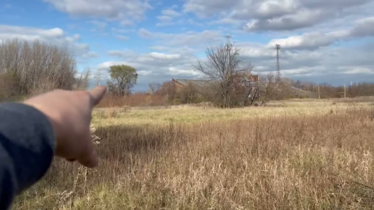
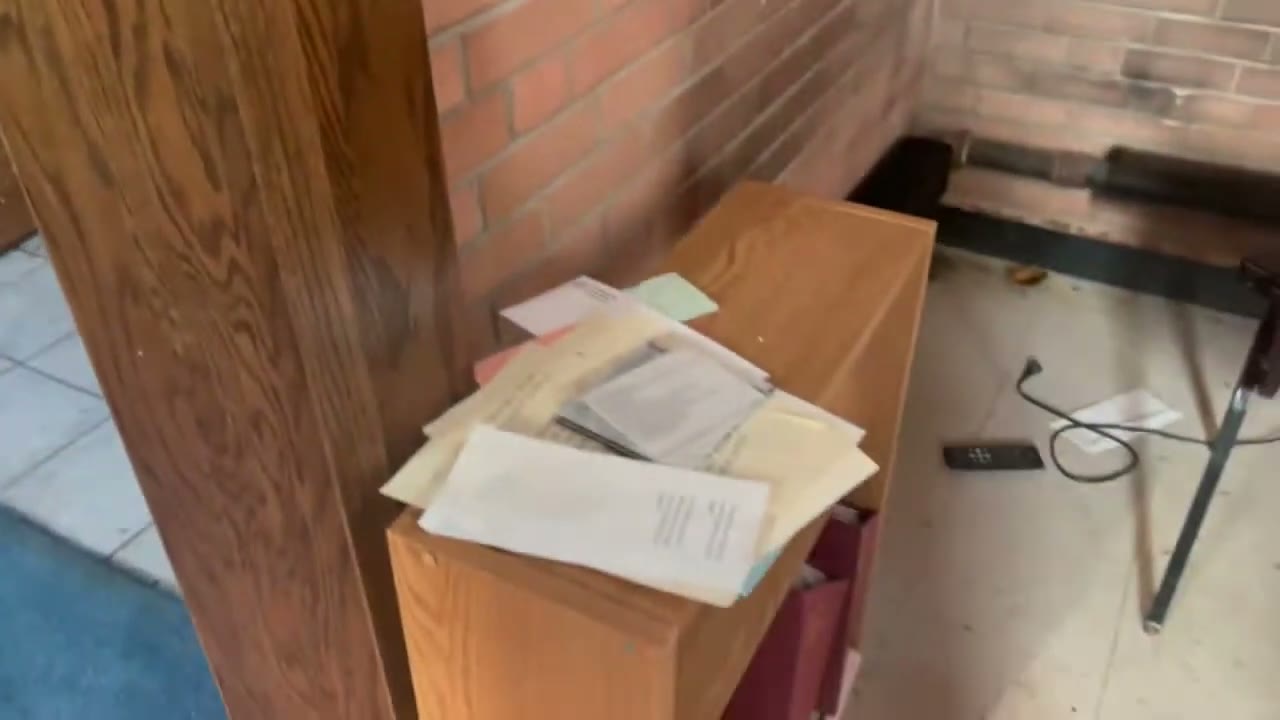
Take the Gilroy Stadium video. Its description says the stadium was built in 1956 for more than $1 million and never completed, that the north stands started falling apart almost right away, and that by the mid 1960s the Gary schools refused to use it for safety reasons. Those are the kinds of dates and dollar figures a newspaper archive or school records can back up. In the tennis building I read a date off a pile of books, October and November of 1995. A date on an object tells you when someone last touched a place, not when it closed.
The Loves Park church video is titled as closed since 2019, and its description says the church is now demolished. A wrecking permit or a local news story would confirm the demolition date, and a county record would show who owned the land.
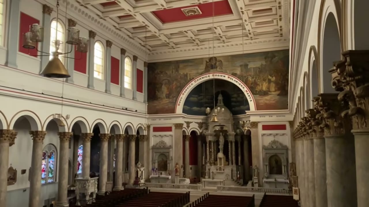
Even without naming the place, that lettering is a lead. It suggests which community built the church, which points to parish histories and newspapers in that language.
A building’s story is usually spread across five or six offices. The parcel number is the thread that ties them together.
Sources
- New Fire Insurance Map Research Guide Available, Library of Congress Maps blog, May 2021
- Chronicling America, Historic American Newspapers, National Endowment for the Humanities, accessed Nov 4, 2026
- Illinois Digital Newspaper Collections, University of Illinois Urbana-Champaign Library, accessed Nov 4, 2026
- How to Research Your Historic Virginia Property, Virginia Department of Historic Resources, 2013
- Find out more information about your property, Cook County Assessor's Office, accessed Nov 4, 2026
- About Property Index Number (PIN), Cook County Clerk, accessed Nov 4, 2026
- Building Permits, City of Chicago Department of Buildings, accessed Nov 4, 2026
- Historic Architectural Resources Geographic Information System (HARGIS), Illinois Department of Natural Resources Historic Preservation Division, accessed Nov 4, 2026
More like this



The footage that never goes public lives on Patreon. It's paid, and it's where the rough cuts, the security run-ins and the early releases go.